Quick Answer: Yarbo’s RTK GPS technology redefines robotic lawn mower navigation by providing centimeter-level precision positioning that eliminates the need for perimeter boundary wires, allowing for hands-free, error-free operation even across complex terrains and large properties up to 6 acres.
The future of autonomous yard maintenance lies in precision and freedom. Traditional robotic mowers rely on physical perimeter wires or inconsistent sensors (Lidar/Vision) to operate. Yarbo breaks this barrier using Real-Time Kinematic (RTK) GPS, transforming the mowing experience from complicated setup to seamless automation. This dedicated technology page explains the fundamental difference between wire-free RTK GPS navigation and conventional mowing methods.
Why Traditional Mowing Navigation Fails Large, Complex Lawns
Before advanced AI, robotic mowers faced limitations that restricted them to simple, flat yards. These limitations are primarily rooted in outdated navigation methods:
-
Boundary Wires: Traditional mowers require users to bury or stake perimeter wires. This setup is labor-intensive, easily damaged (by shovels, animals, or weather), and must be re-installed if the yard changes.
-
Lidar and Single Vision Systems: While LiDAR or basic vision systems offer navigation, they suffer from reliability issues, particularly in complex environments. Lidar struggles with dense foliage or fog, and single vision cameras can lose track in rapidly changing light conditions or under heavy tree cover.
The modern homeowner needs a solution that is "wire-free, error-free, and requires zero installation".
How RTK GPS Works in Yarbo Robotic Lawn Mowing
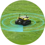
RTK (Real-Time Kinematic) GPS uses a fixed base station and a mobile receiver on the mower to deliver real-time corrections, achieving 1–2 cm accuracy. This allows Yarbo automatic lawn mower with gps to navigate your yard without any physical guides, while adapting dynamically to complex landscapes.
-
Animation Demo explaining RTK-GPS vs. traditional methods:
-
Key Advantage: No perimeter wires, no signal interference from obstacles, no manual remapping.
The Technical Edge: How Yarbo Achieves Centimeter-Level Precision
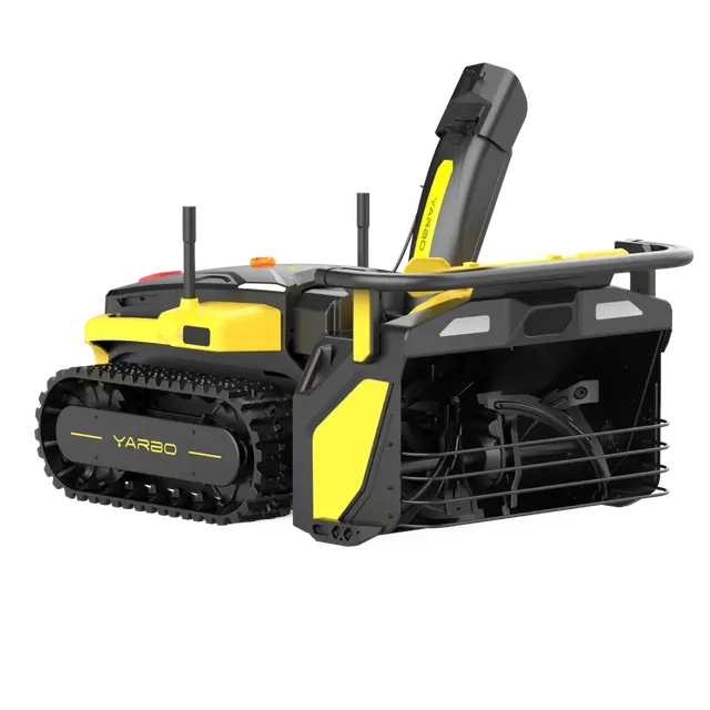
Yarbo’s navigation is centered on RTK GPS combined with multi-sensor fusion, providing the necessary redundancy and accuracy for complex, real-world conditions. RTK significantly enhances standard GPS by using a fixed base station to correct errors in real-time, delivering accuracy down to the centimeter.

Multi-Positioning Navigation System
Yarbo's navigation relies on a robust combination of sensors:
-
RTK GPS: Provides highly accurate global positioning, crucial for large properties and defining precise edges.
-
IMU (Inertial Measurement Unit) & ODOM Sensors: Compensate for movement when satellite signals are momentarily weak (e.g., under tree cover or near buildings).
-
Binocular Cameras & Ultrasonic Sensors: Enable 360° obstacle detection and real-time mapping of the operating environment, identifying people, pets, or debris.
-
Dual-Antenna System: Helps maintain navigation stability and accurate positioning, eliminating the need for manual calibration.
This fusion of technology ensures smart path planning and allows the machine to operate completely autonomously.
Comparison: RTK GPS vs. Traditional Navigation
The shift to RTK GPS is an absolute advantage in the residential robotics market.
| Feature | Yarbo (RTK GPS/AI Vision) | Traditional Wired/Lidar Mowers |
| Positioning Accuracy | Centimeter-Level Precision | Meter-level accuracy or reliant on physical wires |
| Boundary Setup | Wire-Free (App-mapped zones) | Requires labor-intensive physical wire installation |
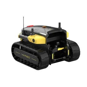
| Terrain Capability | Excellent. Handles slopes up to 35° (70% grade) | Limited to flat or slightly sloped areas; traction issues on slopes |
| Adaptability | High. App allows instant adjustment of no-go zones | Low. Requires digging up and resetting physical wires |
| Signal Robustness | Dual-Antenna and Multi-Sensor Fusion (Vision/IMU/Odom) | Highly susceptible to Lidar blockage (foliage) or GPS drift |
Mastering the Complex Yard: Performance Metrics
The RTK GPS technology allows Yarbo to tackle extreme environments that defeat standard robotic mowers. This capability is critical for Yarbo's target demographic: homeowners with large properties (over 10,000 sq.ft) and complex terrain.
-
Large-Scale Coverage: Yarbo robot lawn mower with gps is engineered to handle expansive spaces, achieving a maximum coverage of up to 6 acres (25,000 ㎡).
-
Steep Slope Mastery: The patented all-terrain tracks and torsion-flexible frame allow the robot lawn mower with gps to operate reliably on hills and uneven surfaces, conquering slopes up to 35° (70% grade).
-
Autonomous Efficiency: The large-capacity 36V/38.4Ah lithium-ion battery supports up to 4 hours of continuous operation on a single charge, automatically returning to its charging station when the battery is low.
-
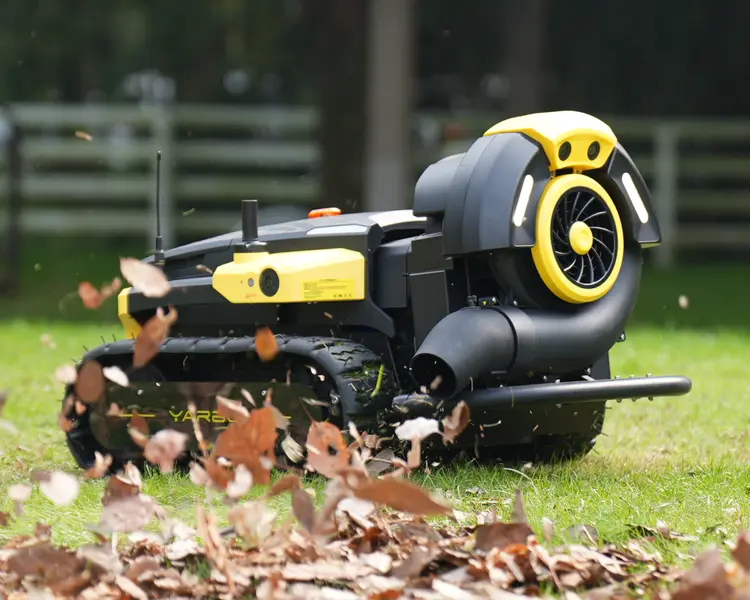
Safety Assurance: The integrated AI system leverages multiple cameras and ultrasonic sensors for 360° obstacle avoidance, safeguarding pets, people, and yard features in real-time.

This technological foundation is why Yarbo automatic lawn mower with gps is positioned as an "all-terrain mastery" solution, delivering consistent cutting precision even when navigating around tree roots, flower beds, or sidewalk curbs.
Why RTK GPS is the Future of Robotic Mowing
-
No Boundaries: Mow anywhere, anytime—even in evolving landscapes.
-
No Errors: No signal drift, no repeated zones, no manual correction.
-
No Installation: Unbox, set up the base, and let Yarbo map your yard automatically.
Conclusion: The Future is Wire-Free Automation
Yarbo’s use of RTK GPS and multi-sensor fusion is not just an incremental improvement; it is the technical barrier that redefines robotic lawn care. By achieving highly reliable, centimeter-level precision without the limitations of boundary wires, the technology addresses major user pain points related to labor, safety risks, and difficulty maintaining large or complex yards. This precision ensures accurate edge identification and trimming and provides the hands-free experience required by modern, high-net-worth homeowners.
FAQs: Yarbo RTK GPS Navigation
Q1: What does RTK GPS mean for robotic lawn mowers?
RTK GPS (Real-Time Kinematic Global Positioning System) allows the robot to achieve positioning accuracy down to the centimeter level. This level of precision eliminates the need for perimeter wires and ensures accurate mowing and navigation, even near delicate edges or obstacles.
Q2: Can Yarbo’s RTK system work under dense tree cover?
Yarbo uses a multi-positioning navigation system that combines RTK GPS with IMU, vision, and odometer sensors. If the GPS signal is temporarily weakened (e.g., under dense trees), the IMU and cameras help maintain accurate navigation.
Q3: How large of a property can Yarbo manage using RTK GPS?
Yarbo automatic lawn mower with gps is engineered for large residential and commercial landscapes and can manage continuous mowing over an area up to 6 acres (25,000 ㎡).
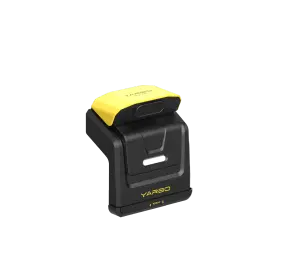
Q4: Do I need to install a base station for the RTK system?
Yes. The RTK system requires a base station (typically the data center) to receive and process satellite signals, providing the real-time corrections necessary for centimeter-level accuracy.
Q5: How does Yarbo handle steep slopes without boundary wires?
Yarbo utilizes patented all-terrain tracks and a torsion-flexible frame, allowing it to maintain powerful traction and stability on steep, uneven terrain, handling slopes up to 35° (70% grade).
Q6: How often does remapping happen?
Only if you significantly alter your landscape. Yarbo robot lawn mower with gps updates maps in real-time during operation.
-7.png?w=1001&h=621)
 Private group · 33.0K members